Asset Reality Capture is a solution that can go by different names, including 3D reality capture and asset capture. But what do these phrases mean in the real world of construction and facilities management? What is Asset Reality Capture, what can you expect from this type of solution, and why should you invest?
The first thing to point out is the phrase Asset Reality Capture is Tantek 4D’s name for a popular solution within our Digital Twin product offering.
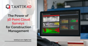
At its core, Asset Reality Capture is a specialist service that uses technologies, expertise, and proven processes to capture physical infrastructures such as buildings, converting them into digital data in the form of 3D representations.
The Output
At Tantek 4D, we like to focus more on the output that our Asset Reality Capture solution produces. The actual Asset Reality Capture process is what we do, and an overview of it is given below. However, the real value for your organisation is the output that is produced.
That output is a 3D digital representation of your building or facility which is the fundamental bedrock of a digital twin. Digital twins are highly visual and interactive datasets that include precise information on geospatial location, size, construction state, structural layout, physical condition, technical specification, markup information, and performance data.
You can then use this 3D digital representation or partial digital twin for a range of uses, from getting the exact width of a doorway to planning and implementing large-scale construction projects.
You will also have a strong foundation to further develop your digital twin. In other words, Asset Reality Capture represents the first stage of a digital twin journey.

Why Invest in Asset Reality Capture?
Our Asset Reality Capture solution, and the digital twin output it produces, can be used for day-to-day operations and facility maintenance. It will also benefit compliance processes and sustainability strategies, and it is invaluable in all types and sizes of projects, including construction projects, remedial work, and modernisation projects.
Some of the main benefits of Asset Reality Capture include:
- Provide project teams with accurate as-built and as-is data.
- Save time as project teams will have immediate access to reliable building data without having to visit the site.
- Reduce costs by reducing the need for site visits, eliminating double work, and improving decision-making.
- Reduce errors, assumptions, and guesswork.
- Help eliminate the known unknowns and the unknown unknowns about your facility and its as-is state.
- Keep workers safe by carrying out virtual pre-construction inductions
- Avoid costly project delays.
- Improve efficiencies.
- Transform work processes.
- Make the sharing of data a standard practice rather than an exception.
Asset Reality Capture will also improve operational and business decision-making. For example, project teams will no longer have to work on assumptions or over-specify because of a lack of accurate data. Instead, decisions on things like costs and specifications can be based on fact.
What is the Asset Reality Capture Process and How Long Does It Take?
Asset Reality Capture is faster than traditional methods of collecting data on buildings and facilities, and it is more accurate. The asset reality capture process is also designed to collect very large amounts of data within short timeframes. Multiple sources of data can also be combined to produce the digital twin output.
There are typically three stages in the process:
- Work on-site to capture the data
- Processing and registering the data
- Hosting the digital twin on a cloud-based platform
On-Site
During the on-site stage, our skilled engineers use the latest technologies to capture vast amounts of data about your building or facility. We use a range of different technologies to capture this data, including:
- LiDAR and laser scanning technologies – laser scanning is a highly accurate method of collecting data on a facility. The lasers create point clouds of measurements which can then be turned into 3D digital representations. LiDAR is a type of laser scanning technology that uses light pulses to create 3D information about a building or facility.
- GPR utility mapping – GPR stands for ground penetrating radar. It is a non-destructive yet accurate method that uses electromagnetic energy to detect and map underground utilities.
- GPR concrete scanning – using similar techniques and equipment to GPR utility mapping, concrete scanning identifies materials and other characteristics of a concrete structure. This includes rebar location and mapping, concrete mass and thickness, tendon or tension cable location, and the location of underfloor heating pipes.
- Survey control networks – a reference system of established control points and benchmarks in your facility that provides a framework for mapping and surveying.
Data Processing
The data processing stage involves transforming the captured data into a usable format. This includes:
- Registering – aligning the various scans taken on-site using common reference points.
- Processing – with the scans aligned, our experienced engineers process the point cloud to set the coordinate system, remove noise, confirm tolerances, and conduct quality checks.
- Georeferencing – assigning geographic coordinates to the point cloud to place it in its precise real-world location.
This part of the process typically takes about the same length of time as the on-site stage. In other words, if we are on-site for two days, the data processing stage will also take approximately two days.
Hosting the Digital Twin
The completed and quality-checked 3D digital representation of your facility is hosted on our cloud-based platform. This platform is interactive, easy to use, and produces outputs that are compatible with common CAD applications, so your teams can start making use of the digital twin in day-to-day operations and in projects.
Getting Control of Building and Facility Data
Our Asset Reality Capture solution makes it possible for you to take control of your building and facility data. With that control, you will have one version of the truth that you can make available to any individual or team that needs it.
From there, the possibilities, returns on investment, and productivity gains are practically endless. It all starts with Asset Reality Capture.