3D Laser Scanning
What is 3D Laser Scanning?
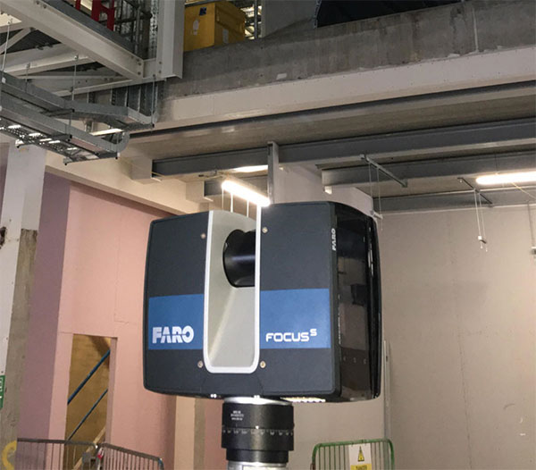
3D laser scanning is a process that uses lasers to capture millions of detailed points of a building, structure or site. These lasers, which pulse hundreds of thousands of times per second, give incredibly accurate measurements between points, creating a 3D collection of XYZ coordinates known as a ‘point cloud’. Specialist software then converts this data into comprehensive 3D models.
Benefits when Using 3D Laser Scanning
- Enables generation of 3D models from point cloud data
- Provides accurate as-built information
- Enables safer surveying practices in hazardous environments, e.g. Rail infrastructure & Motorways
- Reduces surveying field time
- Reduces surveying costs in comparison to traditional methods
- Improves surveying processes and work flows
- Provides high resolution images and data
What is 3D Laser Scanning?
3D laser scanning is a process that uses lasers to capture millions of detailed points of a building, structure or site. These lasers, which pulse hundreds of thousands of times per second, give incredibly accurate measurements between points, creating a 3D collection of XYZ coordinates known as a ‘point cloud’. Specialist software then converts this data into comprehensive 3D models.
Benefits when Using 3D Laser Scanning
- Enables generation of 3D models from point cloud data
- Provides accurate as-built information
- Enables safer surveying practices in hazardous environments, e.g. Rail infrastructure & Motorways
- Reduces surveying field time
- Reduces surveying costs in comparison to traditional methods
- Improves surveying processes and work flows
- Provides high resolution images and data
Internal & External As-Built Surveys
3D scans can be used to develop accurate 3D models of the interior and exterior of existing buildings, which can aid in planning and designing future building works and renovations.
Land Surveys
In order to make sure that infrastructure and building projects proceed according to schedule, organisations need to take advantage of 3D laser scanning technologies which can help survey large areas in a short period of time.
Volume Calculations
Volume calculations can be produced from scan data in order to determine cut and fill figures between a scanned surface and a user-defined plane. Extraction volumes can also be determined between two scanned surfaces to assess the progress of excavation works on a regular basis.
3D Inspection Modelling
3D laser scanning can be used to model and inspect a number of physical objects and surfaces, e.g. structural, building and mechanical surface elements. 3D surface models can be created to confirm that such elements have been produced/constructed and maintained as per the design specification.
Heritage 3D Architectural Archives
3D scanning can be used in conjunction with digital film and photography to build a complete digital representation model of historic buildings and sites.
Forensic Evaluation Surveying
3D scanning can assist with evidence preservation and forensic evaluation. Once data is captured, it can be utilised to construct 3D models which can be subsequently used during mediation, arbitration and litigation.
Progress Reporting
On site progress can be accurately recorded at regular intervals using 3D laser scanning. A point cloud and 360-degree high resolution photoset is produced in order to monitor the progress of projects.
Scan to BIM
Tantek solutions offer a full ‘cradle to grave’ 3D laser scan to BIM service. Once 3D scanning is complete, a point cloud is generated, and is subsequently transposed to a relevant software package for model generation. The model is then used by a multi-discipline design team as a basis for a newly co-ordinated building information model (BIM).