Utility strikes during construction projects and excavation works cause costly damage and project disruption. They also increase safety risks for workers. Identifying and mapping what is under the ground is the best way of preventing utility strikes. This is done through underground utility surveys.
In this blog, we’ll look at the utilities and subsurface features that can be identified and mapped with underground utility surveys, the options available, and how to get the most accurate and cost-effective data.
What Underground Utility Surveys Can Identify
Without causing any physical damage to the site, it is possible using advanced technologies and expertise to identify, map, and analyse a range of utilities, including:
- Water mains
- Gas pipes
- Electricity cables
- Sewers
- Drainage pipes
- Telecommunication lines
- Fibre optic cables
Underground utility surveys can also identify and locate other subsurface features that are important to be aware of in construction, renovation, excavation, and civil engineering projects. This includes geological formations and voids, as well as buried foundations, manholes, and storage tanks.
Underground Utility Mapping Options
Underground utility surveys are also referred to as utility mapping, subsurface utility engineering, and subsurface utility exploration. Mapping underground utilities creates safe, productive, and efficient work environments. There are various methods that can be used, with each offering different levels of accuracy and completeness.
- Use existing drawings and records – offers low levels of accuracy and completeness resulting in low confidence levels.
- Site reconnaissance – produces slightly higher levels of confidence as some information can be determined from visual inspections when combined with existing data, but accuracy is medium-level at best and often much lower.
- Underground utility mapping using advanced, non-destructive methods and technologies – produces high levels of accuracy and confidence.
- Intrusive and destructive excavation inspection – also produces high levels of accuracy and confidence, but the costs and risks are higher than underground utility mapping.
For the vast majority of projects and situations, underground utility mapping using advanced, non-destructive methods and technologies is the best approach.
Features of Advanced, Non-Destructive Subsurface Utility Exploration
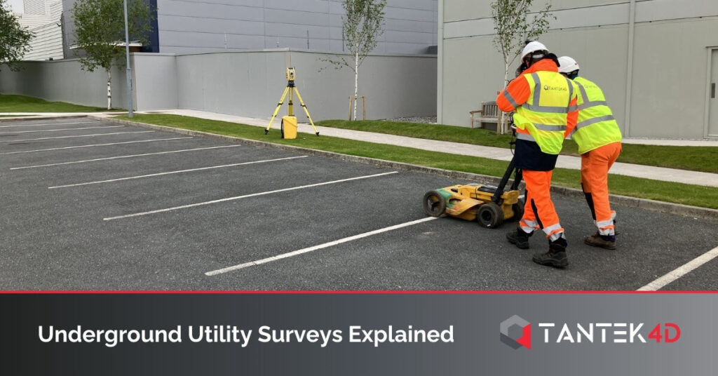
The technologies used to complete advanced, non-destructive utility mapping surveys include:
- Electromagnetic detection
- Radiofrequency location
- Ground penetrating radar
A combination of technologies is used to produce the best results, with surveys conducted by skilled and experienced engineers and technicians.
Key features of the underground utility data that is produced include:
- Highly accurate and precise locations of utilities and other important subsurface features.
- Identifies both horizontal and vertical positions of utilities.
- Capable of detecting both metallic and non-metallic utilities.
- Non-destructive process, so there is no damage to the ground or surface features.
- Prevents damage to utilities during the mapping and analysis process.
The Benefits of Underground Utility Surveys
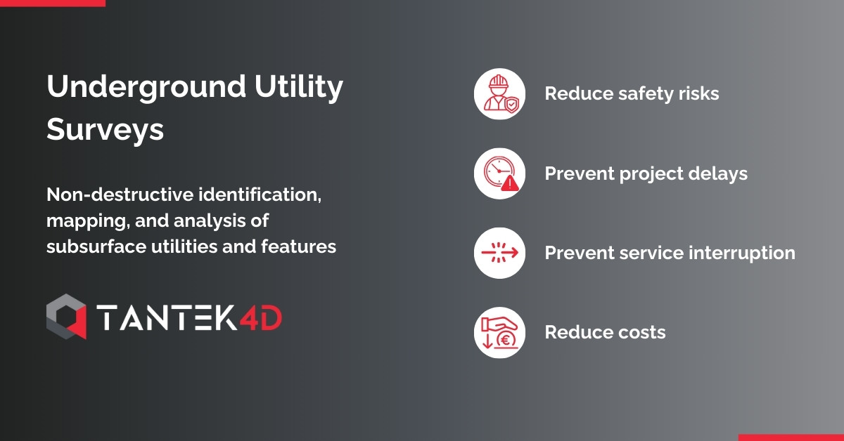
Reduces Safety Risks
The information produced by underground utility surveys helps improve project and site safety by reducing safety risks. This includes reducing the risk of dangerous accidents as well as safety violations that can lead to fines and reputational damage.
Prevents Project Delays
Utility strikes create extra work for project teams that result in costly and disruptive delays. For example, time will need to be spent repairing the damage caused by a utility strike. Design changes might also be needed, causing further delays.
Even if no damage is caused, unexpectedly encountering utilities during construction projects and excavation works causes downtime.
Knowing the precise location of utilities before excavation and other works begin prevents unplanned downtime, utility strikes, and subsequent delays.
Prevents Service Interruptions
Utility strikes that cause damage to pipes, cables, and other infrastructure result in interruptions to those services. This can cause disruption to the project, client, and third parties. That disruption is not only frustrating but can also be costly.
Underground utility surveys prevent service interruptions as the utilities are not disturbed in any way during the identification and mapping process.
Reduces Costs
Even a minor encounter with an unexpected feature underground can result in high additional project costs. From reducing the risk of accidental damage to preventing project delays to avoiding service interruptions, underground utility surveys reduce project costs.
The data that is produced by the survey can also be used for future reference and in future projects, so there is also an ongoing cost benefit.
The Underground Utility Survey Process
At Tantek 4D, our geospatial surveying team has extensive experience conducting underground utility surveys. We also have the latest technologies and equipment, including electromagnetic detection, radio frequency location, and ground-penetrating radar equipment.
To complete a survey for your project, our team will start by analysing existing drawings and information before using our advanced equipment on-site to accurately detect utilities and identify their position. We will then process the data to create 2D and 3D drawings showing the precise spatial layout and location of utilities. We can also mark out the detected utilities on-site.
To find out more and to discuss your requirements, please get in touch with a member of our team.